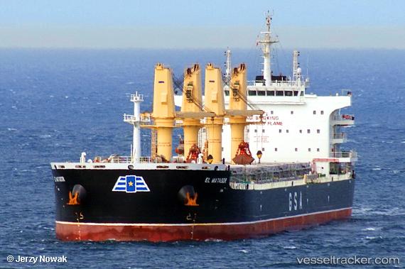
 El Matador
Current Status
Where is the vessel?
El Matador is currently in Near MACAPA, based on AIS data received about 14h ago.
Latest AIS update:
Current position: 0.07385° N, 50.98093° W (Near MACAPA)
Average speed (last 7 days): Loading…
Average speed (last 30 days): Loading…
Vessel profile: El Matador is a Bulk Carrier with dimensions 200m x 200m.
This page combines live AIS, route history, probable destination signals, nearby traffic, and port activity for practical vessel monitoring.
The current position of vessel El Matador is 0.07385 lat / -50.98093 lng. Updated: 2026-05-20 16:30:25 UTCNearest reference points:
- Near Santana
- 55 nm N of Tucuma
- 70 nm N of Tucuma
Currently sailing under the flag of Cyprus ![]()
Details:
Live Vessel El Matador Analytics (details, animations, etc.)
Recent AIS points (UTC):
2026-05-20 13:22:04 UTC · 0.07367, -50.97910 · SOG 0.3 kn · COG 214°2026-05-20 13:48:23 UTC · 0.07476, -50.97947 · SOG 0.2 kn · COG 206°
2026-05-20 15:48:23 UTC · 0.07840, -50.97617 · SOG 2.1 kn · COG 170°
2026-05-20 16:30:25 UTC · 0.07385, -50.98093 · SOG 0.6 kn · COG 192°