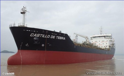
Castillo De Tebra
Current StatusWhere is the vessel?
Castillo De Tebra is currently in 31 nm SE of Ituberá, based on AIS data received about 14h ago.
Latest AIS update:
Current position: 14.02370° S, 38.71150° W (31 nm SE of Ituberá)
Average speed (last 7 days): Loading…
Average speed (last 30 days): Loading…
Vessel profile: Castillo De Tebra is a Chemical Tanker with dimensions 22m x 120m.
This page combines live AIS, route history, probable destination signals, nearby traffic, and port activity for practical vessel monitoring.
The current position of vessel Castillo De Tebra is -14.02370 lat / -38.71150 lng. Updated: 2026-07-08 07:04:33 UTCDetails:
Live Vessel Castillo De Tebra Analytics (details, animations, etc.)
Recent AIS points (UTC):
2026-07-08 03:45:20 UTC · -14.68337, -38.81876 · SOG 11.7 kn · COG 9°2026-07-08 04:45:21 UTC · -14.48752, -38.78901 · SOG 11.9 kn · COG 9°
2026-07-08 06:02:42 UTC · -14.23206, -38.74717 · SOG 12.1 kn · COG 10°
2026-07-08 07:04:33 UTC · -14.02370, -38.71150 · SOG 12.4 kn · COG 9°