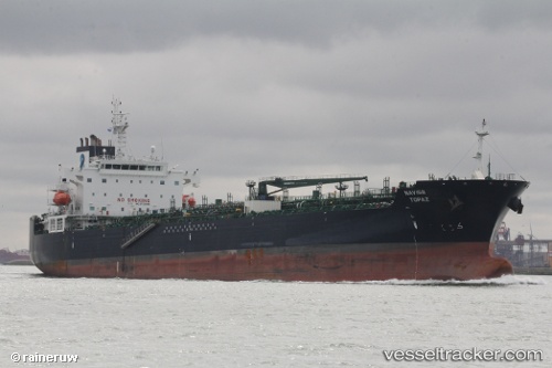
 NAVIG8 TOPAZ
Current Status
Where is the vessel?
NAVIG8 TOPAZ is currently in Near ZHOUSHAN, based on AIS data received about 14h ago.
Latest AIS update:
Current position: 29.94085° N, 122.25555° E (Near ZHOUSHAN)
Average speed (last 7 days): Loading…
Average speed (last 30 days): Loading…
Vessel profile: NAVIG8 TOPAZ is a Oil/Chemical Tanker with dimensions 183m x 32m.
This page combines live AIS, route history, probable destination signals, nearby traffic, and port activity for practical vessel monitoring.
The current position of vessel NAVIG8 TOPAZ is 29.94085 lat / 122.25555 lng. Updated: 2026-07-08 07:06:49 UTCNearest reference points:
- Near ZHOUSHAN
- Near Majistan/Zhoushan
Currently sailing under the flag of Marshall Islands ![]()
NAVIG8 TOPAZ built in 2016 year
Deadweight:
49561 tDetails:
Live Vessel NAVIG8 TOPAZ Analytics (details, animations, etc.)
Recent AIS points (UTC):
2026-07-08 04:15:49 UTC · 29.94090, 122.25561 · SOG 0 kn · COG 286°2026-07-08 04:21:49 UTC · 29.94091, 122.25561 · SOG 0 kn · COG 286°
2026-07-08 06:10:02 UTC · 29.94089, 122.25561 · SOG 0 kn · COG 286°
2026-07-08 07:06:49 UTC · 29.94085, 122.25555 · SOG 0 kn · COG 286°