 MAERSK INVENTOR
Current Status
Where is the vessel?
MAERSK INVENTOR is currently in Near Dampier, based on AIS data received about 16h ago.
Latest AIS update:
Current position: 20.60286° S, 116.57961° E (Near Dampier)
Average speed (last 7 days): Loading…
Average speed (last 30 days): Loading…
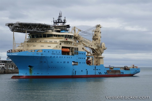
Vessel profile: MAERSK INVENTOR is a Offshore Support Vessel with dimensions 138m x 27m.
This page combines live AIS, route history, probable destination signals, nearby traffic, and port activity for practical vessel monitoring.
The current position of vessel MAERSK INVENTOR is -20.60286 lat / 116.57961 lng. Updated: 2026-05-21 05:39:41 UTCNearest reference points:
- 11 nm E of Port Walcot
- 116 nm NE of Mutineer
Currently sailing under the flag of Denmark (DIS) ![]()
MAERSK INVENTOR built in 2018 year
Deadweight:
9734 tDetails:
Live Vessel MAERSK INVENTOR Analytics (details, animations, etc.)
Recent AIS points (UTC):
2026-05-21 02:36:42 UTC · -20.60310, 116.57957 · SOG 0 kn · COG 66°2026-05-21 03:57:43 UTC · -20.60271, 116.57973 · SOG 0 kn · COG 80°
2026-05-21 04:15:42 UTC · -20.60271, 116.57975 · SOG 0 kn · COG 80°
2026-05-21 05:39:41 UTC · -20.60286, 116.57961 · SOG 0.2 kn · COG 80°