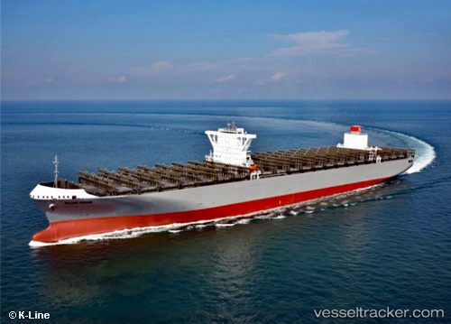
Milano Bridge
Current StatusWhere is the vessel?
Milano Bridge is currently in 164 nm W of Jonesville, based on AIS data received about 14h ago.
Latest AIS update:
Current position: 39.32957° N, 56.90075° W (164 nm W of Jonesville)
Average speed (last 7 days): Loading…
Average speed (last 30 days): Loading…
Vessel profile: Milano Bridge is a Container Ship with dimensions 51m x 365m.
This page combines live AIS, route history, probable destination signals, nearby traffic, and port activity for practical vessel monitoring.
The current position of vessel Milano Bridge is 39.32957 lat / -56.90075 lng. Updated: 2026-05-19 21:39:31 UTCNearest reference points:
- 153 nm NW of Jonesville
- 260 nm W of Jonesville
Details:
Live Vessel Milano Bridge Analytics (details, animations, etc.)
Recent AIS points (UTC):
2026-05-19 18:23:09 UTC · 38.81394, -56.27222 · SOG 12.9 kn · COG 328°2026-05-19 19:09:53 UTC · 38.93425, -56.43283 · SOG 13.1 kn · COG 315°
2026-05-19 19:54:29 UTC · 39.05036, -56.57827 · SOG 13.1 kn · COG 318°
2026-05-19 21:39:31 UTC · 39.32957, -56.90075 · SOG 12.9 kn · COG 315°