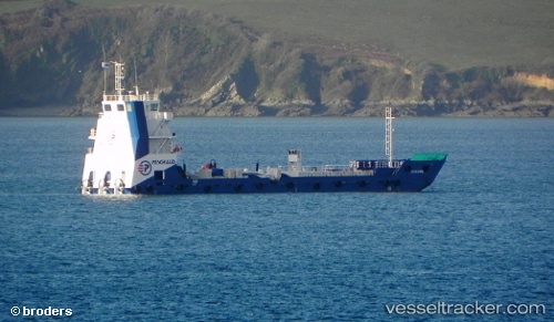
Celeste
Current StatusWhere is the vessel?
Celeste is currently in Near Pointe Noire, based on AIS data received about 15h ago.
Latest AIS update:
Current position: 4.77757° S, 11.85145° E (Near Pointe Noire)
Average speed (last 7 days): Loading…
Average speed (last 30 days): Loading…
Vessel profile: Celeste is a Landing Craft with dimensions 14m x 58m.
This page combines live AIS, route history, probable destination signals, nearby traffic, and port activity for practical vessel monitoring.
The current position of vessel Celeste is -4.77757 lat / 11.85145 lng. Updated: 2026-07-02 14:13:18 UTCNearest reference points:
- Near Pointe Noire
- Near Futila Terminal
- Near N'Kossa Terminal
Details:
Live Vessel Celeste Analytics (details, animations, etc.)
Recent AIS points (UTC):
2026-07-02 10:15:08 UTC · -4.77757, 11.85144 · SOG 0 kn · COG -1°2026-07-02 11:30:59 UTC · -4.77755, 11.85141 · SOG 0 kn · COG -1°
2026-07-02 13:09:29 UTC · -4.77753, 11.85146 · SOG 0 kn · COG -1°
2026-07-02 14:13:18 UTC · -4.77757, 11.85145 · SOG 0.1 kn · COG -1°