 vesseltracker.com
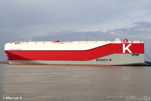
 Olympian Highway
Current Status
Where is the vessel?
Olympian Highway is currently in Near TOYOHASHI, based on AIS data received about 15h ago.
Latest AIS update:
Current position: 34.73391° N, 137.31403° E (Near TOYOHASHI)
Average speed (last 7 days): Loading…
Average speed (last 30 days): Loading…
Vessel profile: Olympian Highway is a Vehicles Carrier with dimensions 199m x 38m.
This page combines live AIS, route history, probable destination signals, nearby traffic, and port activity for practical vessel monitoring.
The current position of vessel Olympian Highway is 34.73391 lat / 137.31403 lng. Updated: 2026-05-18 05:47:04 UTCNearest reference points:
- Near TOYOHASHI
- 17 nm S of TOYOHASHI
- Near Mihama
Currently sailing under the flag of Japan ![]()
Details:
Live Vessel Olympian Highway Analytics (details, animations, etc.)
Recent AIS points (UTC):
2026-05-18 01:41:06 UTC · 34.73389, 137.31409 · SOG 0 kn · COG 284°2026-05-18 03:26:07 UTC · 34.73392, 137.31409 · SOG 0 kn · COG 284°
2026-05-18 04:23:05 UTC · 34.73394, 137.31406 · SOG 0 kn · COG 284°
2026-05-18 05:47:04 UTC · 34.73391, 137.31403 · SOG 0 kn · COG 284°