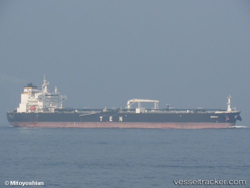
 Sunray
Current Status
Where is the vessel?
Sunray is currently in 248 nm SW of Santo Tomas, based on AIS data received about 16h ago.
Latest AIS update:
Current position: 29.79016° N, 121.03050° W (248 nm SW of Santo Tomas)
Average speed (last 7 days): Loading…
Average speed (last 30 days): Loading…
Vessel profile: Sunray is a Crude Oil Tanker with dimensions 228m x 32m.
This page combines live AIS, route history, probable destination signals, nearby traffic, and port activity for practical vessel monitoring.
The current position of vessel Sunray is 29.79016 lat / -121.03050 lng. Updated: 2026-07-05 01:22:14 UTCNearest reference points:
- Open sea, approx. 404 nm off the nearest listed port
- Open sea, approx. 400 nm off the nearest listed port
- Open sea, approx. 403 nm off the nearest listed port
Currently sailing under the flag of Liberia ![]()
Details:
Live Vessel Sunray Analytics (details, animations, etc.)
Recent AIS points (UTC):
2026-07-04 21:56:44 UTC · 29.40971, -120.48626 · SOG 10.8 kn · COG 307°2026-07-04 22:05:53 UTC · 29.42671, -120.51068 · SOG 10.7 kn · COG 307°
2026-07-04 23:25:25 UTC · 29.57245, -120.72420 · SOG 10.6 kn · COG 307°
2026-07-05 01:22:14 UTC · 29.79016, -121.03050 · SOG 10.7 kn · COG 308°