 vesseltracker.com
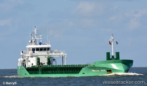
 Arklow Vale
Current Status
Where is the vessel?
Arklow Vale is currently in Near Moelfre, based on AIS data received about 1h ago.
Latest AIS update:
Current position: 53.37535° N, 4.22445° W (Near Moelfre)
Average speed (last 7 days): Loading…
Average speed (last 30 days): Loading…
Vessel profile: Arklow Vale is a General Cargo Ship with dimensions 87m x 15m.
This page combines live AIS, route history, probable destination signals, nearby traffic, and port activity for practical vessel monitoring.
The current position of vessel Arklow Vale is 53.37535 lat / -4.22445 lng. Updated: 2026-05-16 13:28:17 UTCNearest reference points:
- Near Conwy (Conway)
- Near Holyhead
- Near Rhôs-on-Sea
Currently sailing under the flag of Netherlands ![]()
Details:
Live Vessel Arklow Vale Analytics (details, animations, etc.)
Recent AIS points (UTC):
2026-05-16 10:07:19 UTC · 53.37493, -4.22400 · SOG 0 kn · COG 170°2026-05-16 12:10:18 UTC · 53.37522, -4.22447 · SOG 0.3 kn · COG 160°
2026-05-16 13:10:18 UTC · 53.37533, -4.22442 · SOG 0 kn · COG 166°
2026-05-16 13:28:17 UTC · 53.37535, -4.22445 · SOG 0.1 kn · COG 168°