 Sea Garnet
Current Status
Where is the vessel?
Sea Garnet is currently in Open sea (no nearby ports in database), based on AIS data received about 15h ago.
Latest AIS update:
Current position: 12.94654° N, 49.00865° W (Open sea (no nearby ports in database))
Average speed (last 7 days): Loading…
Average speed (last 30 days): Loading…
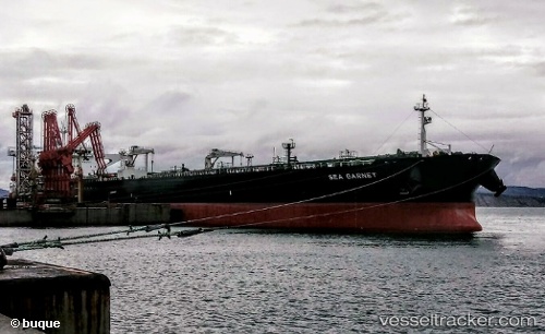
Vessel profile: Sea Garnet is a Crude Oil Tanker with dimensions 273m x 47m.
This page combines live AIS, route history, probable destination signals, nearby traffic, and port activity for practical vessel monitoring.
The current position of vessel Sea Garnet is 12.94654 lat / -49.00865 lng. Updated: 2026-05-22 04:03:52 UTCNearest reference points:
- Open sea (no nearby ports in database)
- Open sea, approx. 523 nm off the nearest listed port
- Open sea, approx. 521 nm off the nearest listed port
Currently sailing under the flag of Marshall Is ![]()
Details:
Live Vessel Sea Garnet Analytics (details, animations, etc.)
Recent AIS points (UTC):
2026-05-22 01:05:32 UTC · 13.19786, -48.58538 · SOG 9.8 kn · COG 235°2026-05-22 02:18:15 UTC · 13.09530, -48.75902 · SOG 9.8 kn · COG 235°
2026-05-22 03:38:13 UTC · 12.98330, -48.94834 · SOG 9.7 kn · COG 235°
2026-05-22 04:03:52 UTC · 12.94654, -49.00865 · SOG 9.7 kn · COG 235°