 vesseltracker.com
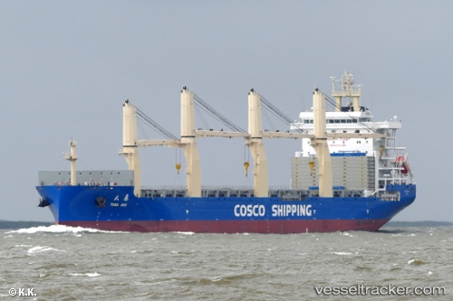
 Tian Hui
Current Status
Where is the vessel?
Tian Hui is currently in 191 nm SE of Port Raysut, based on AIS data received about 5h ago.
Latest AIS update:
Current position: 15.17068° N, 56.77966° E (191 nm SE of Port Raysut)
Average speed (last 7 days): Loading…
Average speed (last 30 days): Loading…
Vessel profile: Tian Hui is a General Cargo Ship with dimensions 190m x 190m.
This page combines live AIS, route history, probable destination signals, nearby traffic, and port activity for practical vessel monitoring.
The current position of vessel Tian Hui is 15.17068 lat / 56.77966 lng. Updated: 2026-05-13 10:44:52 UTCNearest reference points:
- 91 nm S of Pizhou
- 103 nm S of Port Raysut
Currently sailing under the flag of China ![]()
Details:
Live Vessel Tian Hui Analytics (details, animations, etc.)
Recent AIS points (UTC):
2026-05-13 10:44:52 UTC · 15.17068, 56.77966 · SOG 14.1 kn · COG 94°2026-05-13 10:44:52 UTC · 15.17068, 56.77966 · SOG 14.1 kn · COG 94°
2026-05-13 10:44:52 UTC · 15.17068, 56.77966 · SOG 14.1 kn · COG 94°
2026-05-13 10:44:52 UTC · 15.17068, 56.77966 · SOG 14.1 kn · COG 94°