 QAMRAN
Current Status
Where is the vessel?
QAMRAN is currently in 69 nm S of Hateruma, based on AIS data received about 14h ago.
Latest AIS update:
Current position: 22.97333° N, 124.23667° E (69 nm S of Hateruma)
Average speed (last 7 days): Loading…
Average speed (last 30 days): Loading…
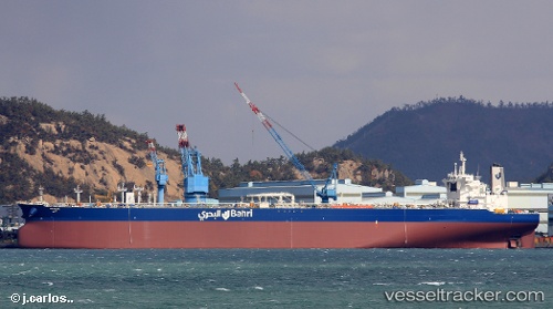
Vessel profile: QAMRAN is a Tanker with dimensions m x m.
This page combines live AIS, route history, probable destination signals, nearby traffic, and port activity for practical vessel monitoring.
The current position of vessel QAMRAN is 22.97333 lat / 124.23667 lng. Updated: 2026-06-13 11:56:27 UTCNearest reference points:
- 26 nm E of Hua-Lien Kang
- 77 nm SE of Miyakojima
- 55 nm E of Nangang
Currently sailing under the flag of Saudi Arabia ![]()
Details:
Live Vessel QAMRAN Analytics (details, animations, etc.)
Recent AIS points (UTC):
2026-06-13 08:11:26 UTC · 22.50333, 123.55667 · SOG 12 kn · COG -1°2026-06-13 09:50:27 UTC · 22.70667, 123.85667 · SOG 12 kn · COG -1°
2026-06-13 10:32:25 UTC · 22.79833, 123.98333 · SOG 12 kn · COG -1°
2026-06-13 11:56:27 UTC · 22.97333, 124.23667 · SOG 12 kn · COG -1°