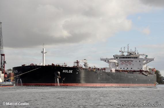
 NOLDE
NOLDE
Current Status
Where is the vessel?
NOLDE is currently in 115 nm SW of Kinfraa-SEZ/Thiruvananthapuram, based on AIS data received about 14h ago.
Latest AIS update:
Current position: 7.22167° N, 75.47167° E (115 nm SW of Kinfraa-SEZ/Thiruvananthapuram)
Average speed (last 7 days): Loading…
Average speed (last 30 days): Loading…
Vessel profile: NOLDE is a Crude Oil Tanker with dimensions 44m x 250m.
This page combines live AIS, route history, probable destination signals, nearby traffic, and port activity for practical vessel monitoring.
The current position of vessel NOLDE is 7.22167 lat / 75.47167 lng. Updated: 2026-05-22 10:09:49 UTCNearest reference points:
- 91 nm S of Nagercoil
- 41 nm S of Nagercoil
- 98 nm S of Nagercoil
Currently sailing under the flag of Marshall Islands ![]()
NOLDE built in 2018 year
Deadweight:
115024 tDetails:
Live Vessel NOLDE Analytics (details, animations, etc.)
Recent AIS points (UTC):
2026-05-22 07:36:47 UTC · 7.08333, 75.90667 · SOG 10 kn · COG -1°2026-05-22 08:03:45 UTC · 7.10500, 75.83333 · SOG 10 kn · COG -1°
2026-05-22 09:24:44 UTC · 7.18167, 75.60667 · SOG 10 kn · COG -1°
2026-05-22 10:09:49 UTC · 7.22167, 75.47167 · SOG 11 kn · COG -1°