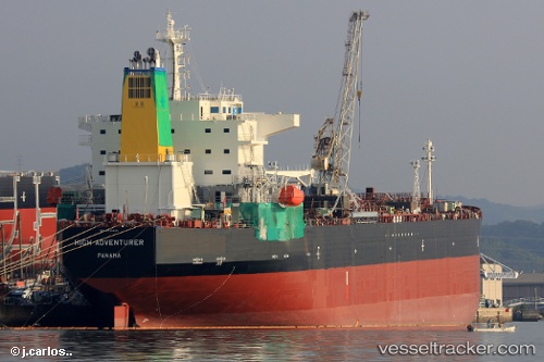
 HIGH ADVENTURER
Current Status
Where is the vessel?
HIGH ADVENTURER is currently in 110 nm NE of Frégate, based on AIS data received about 14h ago.
Latest AIS update:
Current position: 3.31333° S, 57.25167° E (110 nm NE of Frégate)
Average speed (last 7 days): Loading…
Average speed (last 30 days): Loading…
Vessel profile: HIGH ADVENTURER is a Tanker with dimensions m x m.
This page combines live AIS, route history, probable destination signals, nearby traffic, and port activity for practical vessel monitoring.
The current position of vessel HIGH ADVENTURER is -3.31333 lat / 57.25167 lng. Updated: 2026-07-02 22:00:20 UTCNearest reference points:
- Near Mahé Island Apt
Currently sailing under the flag of Liberia ![]()
Details:
Live Vessel HIGH ADVENTURER Analytics (details, animations, etc.)
Recent AIS points (UTC):
2026-07-02 18:10:41 UTC · -3.19625, 57.98381 · SOG 11.7 kn · COG 263°2026-07-02 19:57:20 UTC · -3.24333, 57.64333 · SOG 11 kn · COG -1°
2026-07-02 20:06:19 UTC · -3.24833, 57.61500 · SOG 11 kn · COG -1°
2026-07-02 22:00:20 UTC · -3.31333, 57.25167 · SOG 11 kn · COG -1°