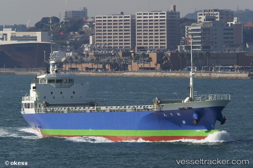
 Ebisu Maru
Current Status
Where is the vessel?
Ebisu Maru is currently in Near KADA, based on AIS data received about 15h ago.
Latest AIS update:
Current position: 34.24549° N, 135.11732° E (Near KADA)
Average speed (last 7 days): Loading…
Average speed (last 30 days): Loading…
Vessel profile: Ebisu Maru is a General Cargo Ship with dimensions 74m x 12m.
This page combines live AIS, route history, probable destination signals, nearby traffic, and port activity for practical vessel monitoring.
The current position of vessel Ebisu Maru is 34.24549 lat / 135.11732 lng. Updated: 2026-05-20 17:06:17 UTCNearest reference points:
- Near KADA
- Near SHIMOTSU
- Near Awaji
Currently sailing under the flag of Japan ![]()
Details:
Live Vessel Ebisu Maru Analytics (details, animations, etc.)
Recent AIS points (UTC):
2026-05-20 13:23:57 UTC · 34.24553, 135.11742 · SOG 0 kn · COG 131°2026-05-20 14:05:58 UTC · 34.24552, 135.11742 · SOG 0 kn · COG 132°
2026-05-20 15:50:56 UTC · 34.24553, 135.11742 · SOG 0 kn · COG 132°
2026-05-20 17:06:17 UTC · 34.24549, 135.11732 · SOG 0 kn · COG 131°