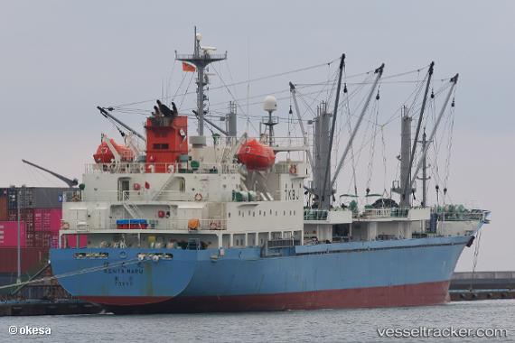
Kenta Maru
Current StatusWhere is the vessel?
Kenta Maru is currently in 13 nm E of Port Lincoln, based on AIS data received about 14h ago.
Latest AIS update:
Current position: 34.64834° S, 136.10921° E (13 nm E of Port Lincoln)
Average speed (last 7 days): Loading…
Average speed (last 30 days): Loading…
Vessel profile: Kenta Maru is a Refrigerated Cargo Ship with dimensions 18m x 122m.
This page combines live AIS, route history, probable destination signals, nearby traffic, and port activity for practical vessel monitoring.
The current position of vessel Kenta Maru is -34.64834 lat / 136.10921 lng. Updated: 2026-05-24 19:45:57 UTCNearest reference points:
- Near Port Lincoln
- 81 nm W of Port Lincoln
- Near North Haven
Details:
Live Vessel Kenta Maru Analytics (details, animations, etc.)
Recent AIS points (UTC):
2026-05-24 16:19:01 UTC · -34.64831, 136.10748 · SOG 0.3 kn · COG 139°2026-05-24 17:52:19 UTC · -34.64667, 136.10667 · SOG 0 kn · COG -1°
2026-05-24 19:42:56 UTC · -34.64837, 136.10927 · SOG 0.1 kn · COG 207°
2026-05-24 19:45:57 UTC · -34.64834, 136.10921 · SOG 0.1 kn · COG 210°