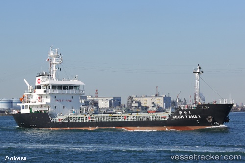
Keum Yang 1
Current StatusWhere is the vessel?
Keum Yang 1 is currently in Near KADA, based on AIS data received about 14h ago.
Latest AIS update:
Current position: 34.31833° N, 135.00166° E (Near KADA)
Average speed (last 7 days): Loading…
Average speed (last 30 days): Loading…
Vessel profile: Keum Yang 1 is a General Cargo Ship with dimensions 14m x 80m.
This page combines live AIS, route history, probable destination signals, nearby traffic, and port activity for practical vessel monitoring.
The current position of vessel Keum Yang 1 is 34.31833 lat / 135.00166 lng. Updated: 2026-05-25 22:10:27 UTCNearest reference points:
- Near KADA
- Near Awaji
- Near SHIMOTSU
Details:
Live Vessel Keum Yang 1 Analytics (details, animations, etc.)
Recent AIS points (UTC):
2026-05-25 19:29:00 UTC · 33.87510, 135.02988 · SOG 10.5 kn · COG 325°2026-05-25 19:43:00 UTC · 33.91234, 135.02100 · SOG 9.9 kn · COG 354°
2026-05-25 21:58:29 UTC · 34.28667, 134.98500 · SOG 10 kn · COG -1°
2026-05-25 22:10:27 UTC · 34.31833, 135.00166 · SOG 10 kn · COG -1°