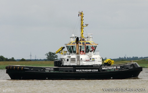
 Multratug 32
Current Status
Where is the vessel?
Multratug 32 is currently in Near Zandvliet, based on AIS data received about 14h ago.
Latest AIS update:
Current position: 51.34806° N, 4.27568° E (Near Zandvliet)
Average speed (last 7 days): Loading…
Average speed (last 30 days): Loading…
Vessel profile: Multratug 32 is a Tug with dimensions 32m x 14m.
This page combines live AIS, route history, probable destination signals, nearby traffic, and port activity for practical vessel monitoring.
The current position of vessel Multratug 32 is 51.34806 lat / 4.27568 lng. Updated: 2026-05-21 04:02:16 UTCNearest reference points:
- Near Doel
- Near Kallo
- Near Verrebroek
Currently sailing under the flag of Netherlands ![]()
Details:
Live Vessel Multratug 32 Analytics (details, animations, etc.)
Recent AIS points (UTC):
2026-05-20 23:26:26 UTC · 51.34801, 4.27572 · SOG 0.1 kn · COG 289°2026-05-21 01:26:36 UTC · 51.34802, 4.27576 · SOG 0.1 kn · COG 294°
2026-05-21 01:46:06 UTC · 51.34802, 4.27576 · SOG 0.1 kn · COG 292°
2026-05-21 04:02:16 UTC · 51.34806, 4.27568 · SOG 0.2 kn · COG 290°