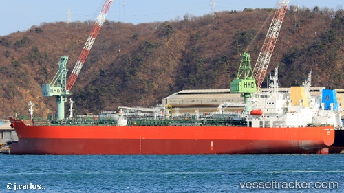
Atlantic Journey
Current StatusWhere is the vessel?
Atlantic Journey is currently in Near Carlyss, based on AIS data received about 15h ago.
Latest AIS update:
Current position: 30.17574° N, 93.31856° W (Near Carlyss)
Average speed (last 7 days): Loading…
Average speed (last 30 days): Loading…
Vessel profile: Atlantic Journey is a Chemical Oil Products Tanker with dimensions 32m x 183m.
This page combines live AIS, route history, probable destination signals, nearby traffic, and port activity for practical vessel monitoring.
The current position of vessel Atlantic Journey is 30.17574 lat / -93.31856 lng. Updated: 2026-05-22 09:30:35 UTCNearest reference points:
- Near Lake Charles
- Near Carlyss
- Near Atreco
Details:
Live Vessel Atlantic Journey Analytics (details, animations, etc.)
Recent AIS points (UTC):
2026-05-22 06:29:46 UTC · 30.17575, -93.31857 · SOG 0 kn · COG -1°2026-05-22 07:12:33 UTC · 30.17575, -93.31855 · SOG 0 kn · COG 192°
2026-05-22 07:36:39 UTC · 30.17573, -93.31853 · SOG 0 kn · COG -1°
2026-05-22 09:30:35 UTC · 30.17574, -93.31856 · SOG 0 kn · COG 192°