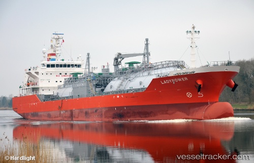
 Ladybower
Current Status
Where is the vessel?
Ladybower is currently in Near Puerto Cortes, based on AIS data received about 14h ago.
Latest AIS update:
Current position: 15.84336° N, 87.96200° W (Near Puerto Cortes)
Average speed (last 7 days): Loading…
Average speed (last 30 days): Loading…
Vessel profile: Ladybower is a Lpg Tanker with dimensions 119m x 23m.
This page combines live AIS, route history, probable destination signals, nearby traffic, and port activity for practical vessel monitoring.
The current position of vessel Ladybower is 15.84336 lat / -87.96200 lng. Updated: 2026-05-21 02:15:47 UTCNearest reference points:
- 14 nm NW of Puerto Cortes
- 26 nm SE of Dangriga
- 12 nm SW of Dangriga
Currently sailing under the flag of Singapore ![]()
Details:
Live Vessel Ladybower Analytics (details, animations, etc.)
Recent AIS points (UTC):
2026-05-20 23:09:46 UTC · 15.84337, -87.96202 · SOG 0 kn · COG 95°2026-05-21 00:12:43 UTC · 15.84332, -87.96201 · SOG 0 kn · COG 95°
2026-05-21 02:03:47 UTC · 15.84335, -87.96199 · SOG 0 kn · COG 95°
2026-05-21 02:15:47 UTC · 15.84336, -87.96200 · SOG 0 kn · COG 95°