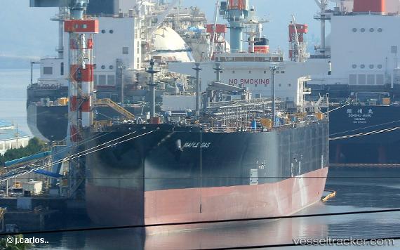
Maple Gas
Current StatusWhere is the vessel?
Maple Gas is currently in 69 nm NE of Port Mathurin, based on AIS data received about 14h ago.
Latest AIS update:
Current position: 19.07317° S, 64.45215° E (69 nm NE of Port Mathurin)
Average speed (last 7 days): Loading…
Average speed (last 30 days): Loading…
Vessel profile: Maple Gas is a Lpg Tanker with dimensions 37m x 230m.
This page combines live AIS, route history, probable destination signals, nearby traffic, and port activity for practical vessel monitoring.
The current position of vessel Maple Gas is -19.07317 lat / 64.45215 lng. Updated: 2026-05-20 15:34:34 UTCNearest reference points:
- 154 nm NE of Port Mathurin
- 106 nm NW of Port Mathurin
Details:
Live Vessel Maple Gas Analytics (details, animations, etc.)
Recent AIS points (UTC):
2026-05-20 11:43:28 UTC · -18.70882, 65.50579 · SOG 16.3 kn · COG 248°2026-05-20 13:33:28 UTC · -18.88364, 65.00874 · SOG 16.9 kn · COG 248°
2026-05-20 13:35:22 UTC · -18.88657, 64.99974 · SOG 17.1 kn · COG 249°
2026-05-20 15:34:34 UTC · -19.07317, 64.45215 · SOG 16.6 kn · COG 244°