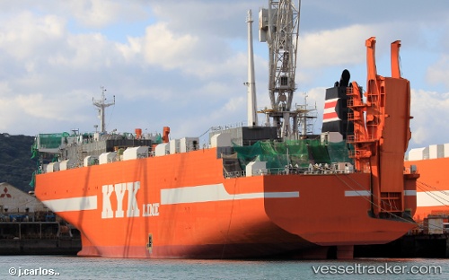
Mashu
Current StatusWhere is the vessel?
Mashu is currently in 19 nm NE of Hachimantai, based on AIS data received about 14h ago.
Latest AIS update:
Current position: 40.14559° N, 141.98967° E (19 nm NE of Hachimantai)
Average speed (last 7 days): Loading…
Average speed (last 30 days): Loading…
Vessel profile: Mashu is a Ro Ro Cargo Ship with dimensions 27m x 180m.
This page combines live AIS, route history, probable destination signals, nearby traffic, and port activity for practical vessel monitoring.
The current position of vessel Mashu is 40.14559 lat / 141.98967 lng. Updated: 2026-05-20 00:06:56 UTCNearest reference points:
- 26 nm E of Hachinohe
- Near OFUNATO
- Near Yokohama, Aomori
Details:
Live Vessel Mashu Analytics (details, animations, etc.)
Recent AIS points (UTC):
2026-05-19 19:41:11 UTC · 41.65892, 141.58150 · SOG 19.9 kn · COG 179°2026-05-19 22:16:02 UTC · 40.78355, 141.76825 · SOG 21.3 kn · COG 163°
2026-05-19 22:26:41 UTC · 40.72145, 141.78282 · SOG 21.1 kn · COG 170°
2026-05-20 00:06:56 UTC · 40.14559, 141.98967 · SOG 22.2 kn · COG 163°