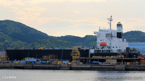
Maple
Current StatusWhere is the vessel?
Maple is currently in 148 nm SE of Campohermoso, based on AIS data received about 14h ago.
Latest AIS update:
Current position: 34.76405° N, 21.35111° W (148 nm SE of Campohermoso)
Average speed (last 7 days): Loading…
Average speed (last 30 days): Loading…
Vessel profile: Maple is a Wood Chips Carrier with dimensions 32m x 210m.
This page combines live AIS, route history, probable destination signals, nearby traffic, and port activity for practical vessel monitoring.
The current position of vessel Maple is 34.76405 lat / -21.35111 lng. Updated: 2026-05-24 19:28:35 UTCNearest reference points:
- 150 nm NW of Ponta do Pargo
- 52 nm S of Campohermoso
Details:
Live Vessel Maple Analytics (details, animations, etc.)
Recent AIS points (UTC):
2026-05-24 16:07:53 UTC · 34.70667, -22.14500 · SOG 11 kn · COG -1°2026-05-24 17:40:53 UTC · 34.73333, -21.77833 · SOG 11 kn · COG -1°
2026-05-24 19:04:53 UTC · 34.75667, -21.44333 · SOG 11 kn · COG -1°
2026-05-24 19:28:35 UTC · 34.76405, -21.35111 · SOG 11.7 kn · COG 87°