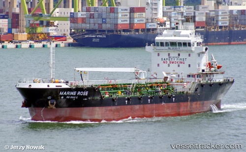
 Marine Rose
Current Status
Where is the vessel?
Marine Rose is currently in Near Tampines, based on AIS data received about 22h ago.
Latest AIS update:
Current position: 1.29673° N, 103.94178° E (Near Tampines)
Average speed (last 7 days): Loading…
Average speed (last 30 days): Loading…
Vessel profile: Marine Rose is a Service Ship with dimensions 88m x 17m.
This page combines live AIS, route history, probable destination signals, nearby traffic, and port activity for practical vessel monitoring.
The current position of vessel Marine Rose is 1.29673 lat / 103.94178 lng. Updated: 2026-07-09 08:08:28 UTCNearest reference points:
- Near Tampines
- Near Changi
- Near Choa Chu Kang
Currently sailing under the flag of Singapore ![]()
Details:
Live Vessel Marine Rose Analytics (details, animations, etc.)
Recent AIS points (UTC):
2026-07-09 05:25:58 UTC · 1.29636, 103.94105 · SOG 0.2 kn · COG 131°2026-07-09 06:13:18 UTC · 1.29655, 103.94101 · SOG 0.1 kn · COG 136°
2026-07-09 07:52:28 UTC · 1.29672, 103.94173 · SOG 0.1 kn · COG 183°
2026-07-09 08:08:28 UTC · 1.29673, 103.94178 · SOG 0 kn · COG 181°