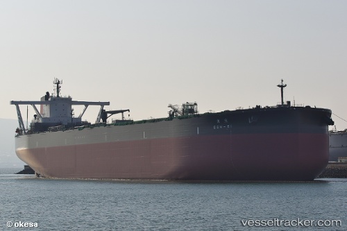
Gen ei
Current StatusWhere is the vessel?
Gen ei is currently in 81 nm SW of Ulju-gun/Ulsan, based on AIS data received about 14h ago.
Latest AIS update:
Current position: 31.45667° N, 128.31833° E (81 nm SW of Ulju-gun/Ulsan)
Average speed (last 7 days): Loading…
Average speed (last 30 days): Loading…
Vessel profile: Gen ei is a Crude Oil Tanker with dimensions 60m x 339m.
This page combines live AIS, route history, probable destination signals, nearby traffic, and port activity for practical vessel monitoring.
The current position of vessel Gen ei is 31.45667 lat / 128.31833 lng. Updated: 2026-05-21 07:49:23 UTCNearest reference points:
- 89 nm SE of Seogwipo
- 131 nm SW of Ulju-gun/Ulsan
- 143 nm S of Seogwipo
Details:
Live Vessel Gen ei Analytics (details, animations, etc.)
Recent AIS points (UTC):
2026-05-21 03:31:27 UTC · 30.99333, 128.78833 · SOG 1 kn · COG -1°2026-05-21 05:37:23 UTC · 31.13833, 128.67000 · SOG 11 kn · COG -1°
2026-05-21 06:55:19 UTC · 31.32500, 128.46500 · SOG 11 kn · COG -1°
2026-05-21 07:49:23 UTC · 31.45667, 128.31833 · SOG 12 kn · COG -1°