 vesseltracker.com
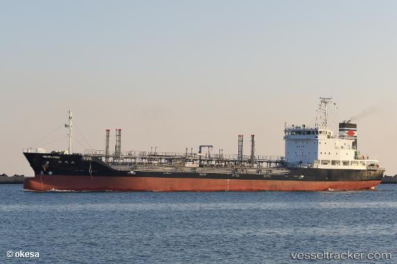
Kaiseimaru
Current StatusWhere is the vessel?
Kaiseimaru is currently in 17 nm NE of Nishitokyo, based on AIS data received about 16h ago.
Latest AIS update:
Current position: 34.97399° N, 139.69948° E (17 nm NE of Nishitokyo)
Average speed (last 7 days): Loading…
Average speed (last 30 days): Loading…
Vessel profile: Kaiseimaru is a Oil Products Tanker with dimensions 16m x 105m.
This page combines live AIS, route history, probable destination signals, nearby traffic, and port activity for practical vessel monitoring.
The current position of vessel Kaiseimaru is 34.97399 lat / 139.69948 lng. Updated: 2026-05-18 07:48:35 UTCNearest reference points:
- 15 nm S of Zushi
- Near Nishitokyo
- Near Yokosuka
Details:
Live Vessel Kaiseimaru Analytics (details, animations, etc.)
Recent AIS points (UTC):
2026-05-18 04:22:23 UTC · 35.53328, 140.05257 · SOG 5.8 kn · COG 313°2026-05-18 05:52:11 UTC · 35.38696, 139.70847 · SOG 13.3 kn · COG 205°
2026-05-18 07:26:53 UTC · 35.05637, 139.72208 · SOG 14.3 kn · COG 191°
2026-05-18 07:48:35 UTC · 34.97399, 139.69948 · SOG 13.5 kn · COG 158°