 Julia
Julia
Current Status
Where is the vessel?
Julia is currently in 10 nm S of QINZHOU, based on AIS data received about 14h ago.
Latest AIS update:
Current position: 21.48237° N, 108.63890° E (10 nm S of QINZHOU)
Average speed (last 7 days): Loading…
Average speed (last 30 days): Loading…
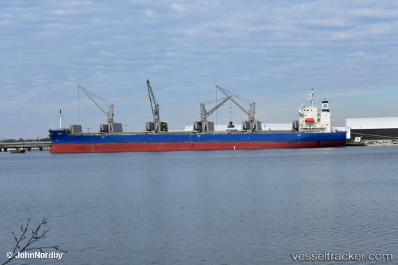
Vessel profile: Julia is a Bulk Carrier with dimensions 180m x 30m.
This page combines live AIS, route history, probable destination signals, nearby traffic, and port activity for practical vessel monitoring.
The current position of vessel Julia is 21.48237 lat / 108.63890 lng. Updated: 2026-05-20 22:03:50 UTCNearest reference points:
- Near Qisha Pt
- Near QINZHOU
- 26 nm SE of Qisha Pt
Currently sailing under the flag of Liberia ![]()
Details:
Live Vessel Julia Analytics (details, animations, etc.)
Recent AIS points (UTC):
2026-05-20 16:36:48 UTC · 20.81080, 109.10230 · SOG 13 kn · COG 324°2026-05-20 17:39:37 UTC · 20.96237, 108.92081 · SOG 13.3 kn · COG 307°
2026-05-20 19:15:57 UTC · 21.14337, 108.69202 · SOG 6.3 kn · COG 265°
2026-05-20 22:03:50 UTC · 21.48237, 108.63890 · SOG 10.3 kn · COG 341°