 vesseltracker.com
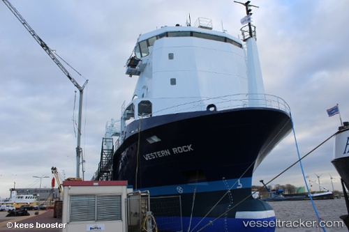
 Western Rock
Current Status
Where is the vessel?
Western Rock is currently in Near Waterford Great Island (ESB), based on AIS data received less than 1h ago.
Latest AIS update:
Current position: 52.26880° N, 7.02803° W (Near Waterford Great Island (ESB))
Average speed (last 7 days): Loading…
Average speed (last 30 days): Loading…
Vessel profile: Western Rock is a General Cargo Ship with dimensions 93m x 14m.
This page combines live AIS, route history, probable destination signals, nearby traffic, and port activity for practical vessel monitoring.
The current position of vessel Western Rock is 52.26880 lat / -7.02803 lng. Updated: 2026-05-14 10:38:47 UTCNearest reference points:
- Near HELVICK
- Near WEXFORD
- Near ARKLOW
Currently sailing under the flag of Netherlands ![]()
Details:
Live Vessel Western Rock Analytics (details, animations, etc.)
Recent AIS points (UTC):
2026-05-14 07:01:13 UTC · 52.26878, -7.02806 · SOG 0 kn · COG 38°2026-05-14 07:22:15 UTC · 52.26877, -7.02804 · SOG 0 kn · COG 38°
2026-05-14 09:43:14 UTC · 52.26879, -7.02805 · SOG 0 kn · COG 38°
2026-05-14 10:38:47 UTC · 52.26880, -7.02803 · SOG 0 kn · COG 37°