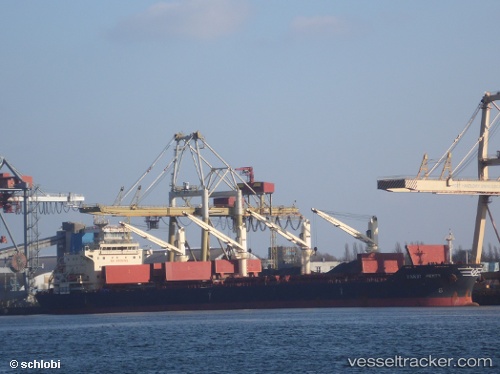
Handy Perth
Current StatusWhere is the vessel?
Handy Perth is currently in 41 nm E of Strå, based on AIS data received about 14h ago.
Latest AIS update:
Current position: 58.00135° N, 20.29341° E (41 nm E of Strå)
Average speed (last 7 days): Loading…
Average speed (last 30 days): Loading…
Vessel profile: Handy Perth is a Bulk Carrier with dimensions 30m x 180m.
This page combines live AIS, route history, probable destination signals, nearby traffic, and port activity for practical vessel monitoring.
The current position of vessel Handy Perth is 58.00135 lat / 20.29341 lng. Updated: 2026-05-27 04:16:02 UTCNearest reference points:
- 37 nm W of Vikati Sadam
- Near Ventspils
- 11 nm N of Ventspils
Details:
Live Vessel Handy Perth Analytics (details, animations, etc.)
Recent AIS points (UTC):
2026-05-27 01:29:41 UTC · 58.47827, 20.81405 · SOG 11.4 kn · COG 212°2026-05-27 01:58:30 UTC · 58.39874, 20.72412 · SOG 11.7 kn · COG 214°
2026-05-27 04:16:02 UTC · 58.00135, 20.29341 · SOG 12.2 kn · COG 205°
2026-05-27 04:16:02 UTC · 58.00135, 20.29341 · SOG 12.2 kn · COG 205°