 vesseltracker.com
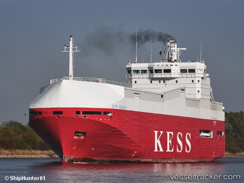
 Ems Highway
Current Status
Where is the vessel?
Ems Highway is currently in 15 nm SE of Craven Arms, based on AIS data received about 14h ago.
Latest AIS update:
Current position: 52.22466° N, 3.04224° E (15 nm SE of Craven Arms)
Average speed (last 7 days): Loading…
Average speed (last 30 days): Loading…
Vessel profile: Ems Highway is a Vehicles Carrier with dimensions 100m x 100m.
This page combines live AIS, route history, probable destination signals, nearby traffic, and port activity for practical vessel monitoring.
The current position of vessel Ems Highway is 52.22466 lat / 3.04224 lng. Updated: 2026-05-17 20:08:41 UTCNearest reference points:
- Near Craven Arms
- Near Hunsdon
- 21 nm S of Craven Arms
Currently sailing under the flag of Cyprus ![]()
Ems Highway built in 1999 year
Deadweight:
3414 tDetails:
Live Vessel Ems Highway Analytics (details, animations, etc.)
Recent AIS points (UTC):
2026-05-17 16:18:30 UTC · 52.79362, 3.71319 · SOG 10.8 kn · COG 215°2026-05-17 18:07:20 UTC · 52.52718, 3.39223 · SOG 10.8 kn · COG 215°
2026-05-17 19:31:52 UTC · 52.31279, 3.15198 · SOG 11.1 kn · COG 215°
2026-05-17 20:08:41 UTC · 52.22466, 3.04224 · SOG 10.8 kn · COG 222°