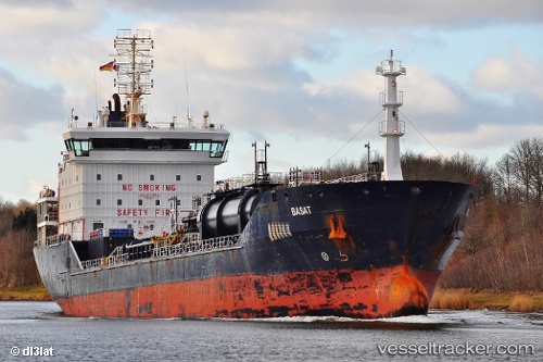
 Basat
Basat
Current Status
Where is the vessel?
Basat is currently in 16 nm NE of Ile D’Ouessant, based on AIS data received about 14h ago.
Latest AIS update:
Current position: 48.89850° N, 5.29400° W (16 nm NE of Ile D’Ouessant)
Average speed (last 7 days): Loading…
Average speed (last 30 days): Loading…
Vessel profile: Basat is a Chemical Oil Products Tanker with dimensions 132m x 19m.
This page combines live AIS, route history, probable destination signals, nearby traffic, and port activity for practical vessel monitoring.
The current position of vessel Basat is 48.89850 lat / -5.29400 lng. Updated: 2026-05-22 01:21:59 UTCNearest reference points:
- 18 nm NE of Ile D’Ouessant
- 34 nm W of Verzy
- 28 nm N of Landunvez
Currently sailing under the flag of Malta ![]()
Basat built in 2008 year
Deadweight:
10745 tDetails:
Live Vessel Basat Analytics (details, animations, etc.)
Recent AIS points (UTC):
2026-05-21 19:56:30 UTC · 48.01483, -6.35733 · SOG 14.1 kn · COG 32°2026-05-21 22:06:33 UTC · 48.42739, -5.93995 · SOG 13.4 kn · COG 32°
2026-05-21 22:24:04 UTC · 48.47937, -5.88698 · SOG 12.9 kn · COG 29°
2026-05-22 01:21:59 UTC · 48.89850, -5.29400 · SOG 11.3 kn · COG 57°