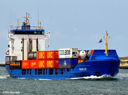
 Marus
Marus
Current Status
Where is the vessel?
Marus is currently in Near Rio Haina, based on AIS data received about 14h ago.
Latest AIS update:
Current position: 18.42147° N, 70.01537° W (Near Rio Haina)
Average speed (last 7 days): Loading…
Average speed (last 30 days): Loading…
Vessel profile: Marus is a Container Ship with dimensions 99m x 16m.
This page combines live AIS, route history, probable destination signals, nearby traffic, and port activity for practical vessel monitoring.
The current position of vessel Marus is 18.42147 lat / -70.01537 lng. Updated: 2026-05-23 08:01:13 UTCNearest reference points:
- Near Bahia De Las Calderas
- Near CASA DE CAMPO
- Near Puerto Plata
Currently sailing under the flag of Antigua Barbuda ![]()
Marus built in 1996 year
Deadweight:
3950 tDetails:
Live Vessel Marus Analytics (details, animations, etc.)
Recent AIS points (UTC):
2026-05-23 04:19:05 UTC · 18.42146, -70.01536 · SOG 0.1 kn · COG 312°2026-05-23 06:22:10 UTC · 18.42151, -70.01535 · SOG 0 kn · COG 311°
2026-05-23 07:49:11 UTC · 18.42148, -70.01533 · SOG 0 kn · COG 311°
2026-05-23 08:01:13 UTC · 18.42147, -70.01537 · SOG 0 kn · COG 311°