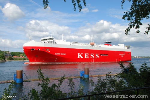
 Danube Highway
Current Status
Where is the vessel?
Danube Highway is currently in 15 nm NW of TERSCHELLING, based on AIS data received about 15h ago.
Latest AIS update:
Current position: 53.55838° N, 4.95493° E (15 nm NW of TERSCHELLING)
Average speed (last 7 days): Loading…
Average speed (last 30 days): Loading…
Vessel profile: Danube Highway is a Vehicles Carrier with dimensions 148m x 148m.
This page combines live AIS, route history, probable destination signals, nearby traffic, and port activity for practical vessel monitoring.
The current position of vessel Danube Highway is 53.55838 lat / 4.95493 lng. Updated: 2026-05-20 19:04:25 UTCNearest reference points:
- Near de Waal
- Near OUDESCHILD
- Near Molengat
Currently sailing under the flag of Bahamas ![]()
Danube Highway built in 2006 year
Deadweight:
7788 tDetails:
Live Vessel Danube Highway Analytics (details, animations, etc.)
Recent AIS points (UTC):
2026-05-20 16:25:16 UTC · 53.68742, 5.97748 · SOG 15.7 kn · COG 340°2026-05-20 16:25:58 UTC · 53.69023, 5.97550 · SOG 15.7 kn · COG 340°
2026-05-20 17:38:16 UTC · 53.67455, 5.50128 · SOG 15.5 kn · COG 250°
2026-05-20 19:04:25 UTC · 53.55838, 4.95493 · SOG 13.3 kn · COG 245°