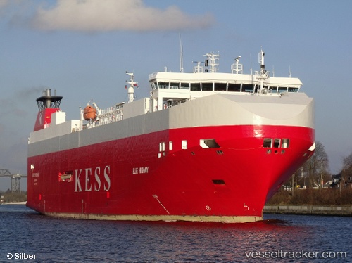
 Elbe Highway
Current Status
Where is the vessel?
Elbe Highway is currently in 30 nm NE of Östhammar, based on AIS data received about 14h ago.
Latest AIS update:
Current position: 60.65501° N, 19.02857° E (30 nm NE of Östhammar)
Average speed (last 7 days): Loading…
Average speed (last 30 days): Loading…
Vessel profile: Elbe Highway is a Vehicles Carrier with dimensions 148m x 25m.
This page combines live AIS, route history, probable destination signals, nearby traffic, and port activity for practical vessel monitoring.
The current position of vessel Elbe Highway is 60.65501 lat / 19.02857 lng. Updated: 2026-05-23 08:01:59 UTCNearest reference points:
- Near Östhammar
- Near Hallstavik
- Near GRADDO
Currently sailing under the flag of Bahamas ![]()
Elbe Highway built in 2005 year
Deadweight:
7750 tDetails:
Live Vessel Elbe Highway Analytics (details, animations, etc.)
Recent AIS points (UTC):
2026-05-23 04:24:16 UTC · 61.54590, 19.39679 · SOG 15.5 kn · COG 192°2026-05-23 05:32:35 UTC · 61.26291, 19.27529 · SOG 15 kn · COG 191°
2026-05-23 07:40:05 UTC · 60.74285, 19.07001 · SOG 14.8 kn · COG 194°
2026-05-23 08:01:59 UTC · 60.65501, 19.02857 · SOG 14.9 kn · COG 194°