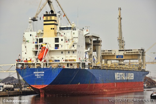
 HOSANGER
Current Status
Where is the vessel?
HOSANGER is currently in 45 nm NE of Polychnitos Lesvou, based on AIS data received about 15h ago.
Latest AIS update:
Current position: 34.50970° N, 26.92552° E (45 nm NE of Polychnitos Lesvou)
Average speed (last 7 days): Loading…
Average speed (last 30 days): Loading…
Vessel profile: HOSANGER is a General Cargo Ship with dimensions 31m x 213m.
This page combines live AIS, route history, probable destination signals, nearby traffic, and port activity for practical vessel monitoring.
The current position of vessel HOSANGER is 34.50970 lat / 26.92552 lng. Updated: 2026-05-21 22:57:34 UTCNearest reference points:
- 91 nm SE of Polychnitos Lesvou
- 20 nm S of Astypálaia
- Near Iraklion
Currently sailing under the flag of Marshall Islands ![]()
HOSANGER built in 1995 year
Deadweight:
50198 tDetails:
Live Vessel HOSANGER Analytics (details, animations, etc.)
Recent AIS points (UTC):
2026-05-21 19:16:24 UTC · 34.51041, 25.99561 · SOG 12.3 kn · COG 87°2026-05-21 19:36:24 UTC · 34.51077, 26.07912 · SOG 12.4 kn · COG 88°
2026-05-21 22:18:15 UTC · 34.50784, 26.76028 · SOG 12.5 kn · COG 88°
2026-05-21 22:57:34 UTC · 34.50970, 26.92552 · SOG 12.4 kn · COG 88°