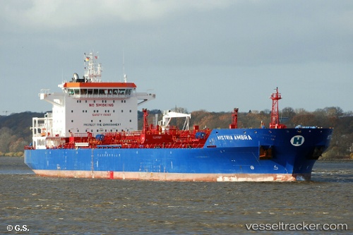
 Histria Ambra
Current Status
Where is the vessel?
Histria Ambra is currently in Near Kumport, based on AIS data received about 14h ago.
Latest AIS update:
Current position: 40.81874° N, 28.83744° E (Near Kumport)
Average speed (last 7 days): Loading…
Average speed (last 30 days): Loading…
Vessel profile: Histria Ambra is a Chemical Oil Products Tanker with dimensions 180m x 32m.
This page combines live AIS, route history, probable destination signals, nearby traffic, and port activity for practical vessel monitoring.
The current position of vessel Histria Ambra is 40.81874 lat / 28.83744 lng. Updated: 2026-05-21 13:07:32 UTCNearest reference points:
- Near Kumport
- 10 nm SE of Kumport
- Near BAKIRKOY
Currently sailing under the flag of Liberia ![]()
Histria Ambra built in 2013 year
Deadweight:
40345 tDetails:
Live Vessel Histria Ambra Analytics (details, animations, etc.)
Recent AIS points (UTC):
2026-05-21 09:54:51 UTC · 40.81365, 28.85723 · SOG 0.3 kn · COG 352°2026-05-21 10:54:23 UTC · 40.81256, 28.86344 · SOG 0.3 kn · COG 336°
2026-05-21 11:25:03 UTC · 40.81216, 28.86668 · SOG 0.2 kn · COG 2°
2026-05-21 13:07:32 UTC · 40.81874, 28.83744 · SOG 0.3 kn · COG 267°