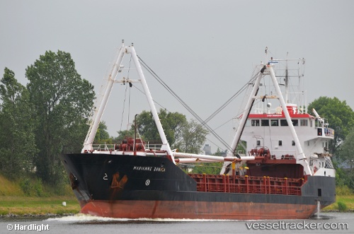
Marianne Danica
Current StatusWhere is the vessel?
Marianne Danica is currently in 47 nm W of Kirstenhof (Kirstenbosch), based on AIS data received about 14h ago.
Latest AIS update:
Current position: 33.84240° S, 17.42527° E (47 nm W of Kirstenhof (Kirstenbosch))
Average speed (last 7 days): Loading…
Average speed (last 30 days): Loading…
Vessel profile: Marianne Danica is a General Cargo Ship with dimensions 12m x 71m.
This page combines live AIS, route history, probable destination signals, nearby traffic, and port activity for practical vessel monitoring.
The current position of vessel Marianne Danica is -33.84240 lat / 17.42527 lng. Updated: 2026-05-21 20:11:51 UTCNearest reference points:
- 12 nm W of ROBBEN ISLAND
- Near HOUT BAY
- Near Cape Town
Details:
Live Vessel Marianne Danica Analytics (details, animations, etc.)
Recent AIS points (UTC):
2026-05-21 17:05:01 UTC · -33.37833, 17.08833 · SOG 10 kn · COG -1°2026-05-21 18:05:05 UTC · -33.53500, 17.18667 · SOG 10 kn · COG -1°
2026-05-21 19:52:14 UTC · -33.79672, 17.38606 · SOG 10.1 kn · COG 143°
2026-05-21 20:11:51 UTC · -33.84240, 17.42527 · SOG 10 kn · COG 142°