 vesseltracker.com
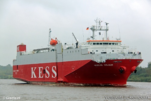
 Schelde Highway
Current Status
Where is the vessel?
Schelde Highway is currently in Near WICKLOW, based on AIS data received about 15h ago.
Latest AIS update:
Current position: 52.87900° N, 5.89511° W (Near WICKLOW)
Average speed (last 7 days): Loading…
Average speed (last 30 days): Loading…
Vessel profile: Schelde Highway is a Vehicles Carrier with dimensions 100m x 21m.
This page combines live AIS, route history, probable destination signals, nearby traffic, and port activity for practical vessel monitoring.
The current position of vessel Schelde Highway is 52.87900 lat / -5.89511 lng. Updated: 2026-05-18 01:33:54 UTCNearest reference points:
- Near ARKLOW
- Near WICKLOW
- Near Dun Laoghaire
Currently sailing under the flag of Panama ![]()
Schelde Highway built in 1993 year
Deadweight:
3222 tDetails:
Live Vessel Schelde Highway Analytics (details, animations, etc.)
Recent AIS points (UTC):
2026-05-17 22:18:55 UTC · 52.60584, -5.89122 · SOG 4.4 kn · COG 351°2026-05-17 23:31:14 UTC · 52.67991, -5.88574 · SOG 2.8 kn · COG 350°
2026-05-18 01:31:14 UTC · 52.87394, -5.89444 · SOG 7 kn · COG 358°
2026-05-18 01:33:54 UTC · 52.87900, -5.89511 · SOG 6.8 kn · COG 358°