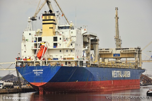
 HOSANGER
Current Status
Where is the vessel?
HOSANGER is currently in 25 nm NE of Isole Tremiti, based on AIS data received about 14h ago.
Latest AIS update:
Current position: 42.46328° N, 15.80238° E (25 nm NE of Isole Tremiti)
Average speed (last 7 days): Loading…
Average speed (last 30 days): Loading…
Vessel profile: HOSANGER is a General Cargo Ship with dimensions 31m x 213m.
This page combines live AIS, route history, probable destination signals, nearby traffic, and port activity for practical vessel monitoring.
The current position of vessel HOSANGER is 42.46328 lat / 15.80238 lng. Updated: 2026-05-19 10:06:54 UTCNearest reference points:
- 26 nm N of Isole Tremiti
- Near TERMOLI
- Near Rogac
Currently sailing under the flag of Marshall Islands ![]()
HOSANGER built in 1995 year
Deadweight:
50198 tDetails:
Live Vessel HOSANGER Analytics (details, animations, etc.)
Recent AIS points (UTC):
2026-05-19 06:05:12 UTC · 43.16277, 15.06949 · SOG 13 kn · COG 138°2026-05-19 07:57:04 UTC · 42.84798, 15.42286 · SOG 13.3 kn · COG 139°
2026-05-19 08:05:04 UTC · 42.82444, 15.44755 · SOG 13.3 kn · COG 140°
2026-05-19 10:06:54 UTC · 42.46328, 15.80238 · SOG 12.8 kn · COG 135°