 Glovis Chorus
Current Status
Where is the vessel?
Glovis Chorus is currently in 48 nm SW of Taniyama, based on AIS data received about 20h ago.
Latest AIS update:
Current position: 30.56352° N, 129.88959° E (48 nm SW of Taniyama)
Average speed (last 7 days): Loading…
Average speed (last 30 days): Loading…
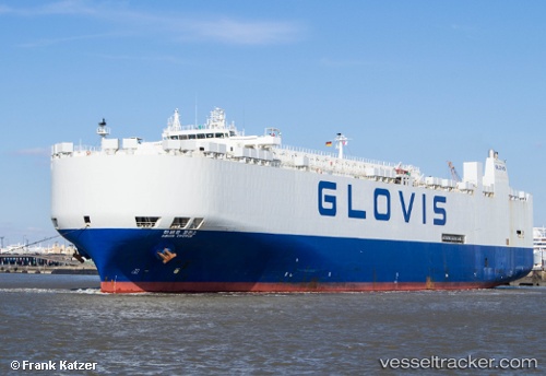
Vessel profile: Glovis Chorus is a Vehicles Carrier with dimensions 200m x 32m.
This page combines live AIS, route history, probable destination signals, nearby traffic, and port activity for practical vessel monitoring.
The current position of vessel Glovis Chorus is 30.56352 lat / 129.88959 lng. Updated: 2026-05-20 00:36:53 UTCNearest reference points:
- 71 nm SW of Taniyama
- Near YAMAGAWA
- Near Kiire
Currently sailing under the flag of Korea ![]()
Glovis Chorus built in 1997 year
Deadweight:
21505 tDetails:
Live Vessel Glovis Chorus Analytics (details, animations, etc.)
Recent AIS points (UTC):
2026-05-20 00:36:53 UTC · 30.56352, 129.88959 · SOG 16.1 kn · COG 264°2026-05-20 00:36:53 UTC · 30.56352, 129.88959 · SOG 16.1 kn · COG 264°
2026-05-20 00:36:53 UTC · 30.56352, 129.88959 · SOG 16.1 kn · COG 264°
2026-05-20 00:36:53 UTC · 30.56352, 129.88959 · SOG 16.1 kn · COG 264°