 Isar Highway
Current Status
Where is the vessel?
Isar Highway is currently in Near Bornholt, based on AIS data received about 14h ago.
Latest AIS update:
Current position: 54.11811° N, 9.32828° E (Near Bornholt)
Average speed (last 7 days): Loading…
Average speed (last 30 days): Loading…
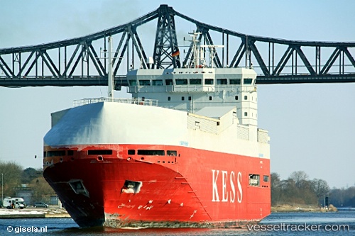
Vessel profile: Isar Highway is a Vehicles Carrier with dimensions 100m x 20m.
This page combines live AIS, route history, probable destination signals, nearby traffic, and port activity for practical vessel monitoring.
The current position of vessel Isar Highway is 54.11811 lat / 9.32828 lng. Updated: 2026-05-19 19:32:17 UTCNearest reference points:
- Near Kiel Canal
- Near BORGSTEDT
- Near Busdorf bei Schleswig
Currently sailing under the flag of Cyprus ![]()
Isar Highway built in 2000 year
Deadweight:
3414 tDetails:
Live Vessel Isar Highway Analytics (details, animations, etc.)
Recent AIS points (UTC):
2026-05-19 16:21:16 UTC · 53.93699, 9.21691 · SOG 4.5 kn · COG 39°2026-05-19 17:22:56 UTC · 53.94509, 9.22880 · SOG 0.5 kn · COG 40°
2026-05-19 19:28:27 UTC · 54.11085, 9.32898 · SOG 6.9 kn · COG 356°
2026-05-19 19:32:17 UTC · 54.11811, 9.32828 · SOG 6.8 kn · COG 2°