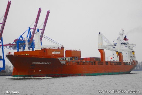
 Suomigracht
Current Status
Where is the vessel?
Suomigracht is currently in 87 nm SE of Beach Haven, based on AIS data received about 14h ago.
Latest AIS update:
Current position: 38.81184° N, 72.61560° W (87 nm SE of Beach Haven)
Average speed (last 7 days): Loading…
Average speed (last 30 days): Loading…
Vessel profile: Suomigracht is a Multi Purpose Carrier with dimensions 186m x 25m.
This page combines live AIS, route history, probable destination signals, nearby traffic, and port activity for practical vessel monitoring.
The current position of vessel Suomigracht is 38.81184 lat / -72.61560 lng. Updated: 2026-05-21 11:59:09 UTCNearest reference points:
- 57 nm E of Fenwick Island
- 13 nm E of Avon-by-the-Sea
- Near Manasquan
Currently sailing under the flag of Netherlands ![]()
Suomigracht built in 2004 year
Deadweight:
23660 tDetails:
Live Vessel Suomigracht Analytics (details, animations, etc.)
Recent AIS points (UTC):
2026-05-21 08:01:09 UTC · 38.81845, -71.37986 · SOG 15.1 kn · COG 269°2026-05-21 09:33:19 UTC · 38.81568, -71.86977 · SOG 14.9 kn · COG 271°
2026-05-21 10:39:08 UTC · 38.81714, -72.22238 · SOG 14.8 kn · COG 268°
2026-05-21 11:59:09 UTC · 38.81184, -72.61560 · SOG 12.6 kn · COG 271°