 vesseltracker.com
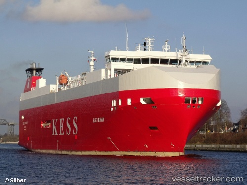
 Elbe Highway
Current Status
Where is the vessel?
Elbe Highway is currently in Near Malmo, based on AIS data received about 14h ago.
Latest AIS update:
Current position: 55.62332° N, 12.99616° E (Near Malmo)
Average speed (last 7 days): Loading…
Average speed (last 30 days): Loading…
Vessel profile: Elbe Highway is a Vehicles Carrier with dimensions 148m x 25m.
This page combines live AIS, route history, probable destination signals, nearby traffic, and port activity for practical vessel monitoring.
The current position of vessel Elbe Highway is 55.62332 lat / 12.99616 lng. Updated: 2026-05-18 02:13:09 UTCNearest reference points:
- Near Malmo
- Near Limhamn
- Near Bjärred
Currently sailing under the flag of Bahamas ![]()
Elbe Highway built in 2005 year
Deadweight:
7750 tDetails:
Live Vessel Elbe Highway Analytics (details, animations, etc.)
Recent AIS points (UTC):
2026-05-17 22:40:10 UTC · 55.62334, 12.99617 · SOG 0 kn · COG 83°2026-05-17 23:22:10 UTC · 55.62329, 12.99624 · SOG 0 kn · COG 83°
2026-05-18 01:46:09 UTC · 55.62331, 12.99622 · SOG 0 kn · COG 83°
2026-05-18 02:13:09 UTC · 55.62332, 12.99616 · SOG 0 kn · COG 83°