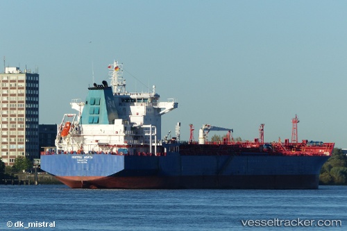
 Histria Agata
Current Status
Where is the vessel?
Histria Agata is currently in 19 nm S of Craven Arms, based on AIS data received about 14h ago.
Latest AIS update:
Current position: 52.11883° N, 2.90913° E (19 nm S of Craven Arms)
Average speed (last 7 days): Loading…
Average speed (last 30 days): Loading…
Vessel profile: Histria Agata is a Chemical Oil Products Tanker with dimensions 180m x 32m.
This page combines live AIS, route history, probable destination signals, nearby traffic, and port activity for practical vessel monitoring.
The current position of vessel Histria Agata is 52.11883 lat / 2.90913 lng. Updated: 2026-05-21 19:54:14 UTCNearest reference points:
- 21 nm S of Craven Arms
- Near Hunsdon
- Near Craven Arms
Currently sailing under the flag of Malta ![]()
Histria Agata built in 2007 year
Deadweight:
40440 tDetails:
Live Vessel Histria Agata Analytics (details, animations, etc.)
Recent AIS points (UTC):
2026-05-21 15:57:44 UTC · 52.53177, 3.82973 · SOG 12.2 kn · COG 260°2026-05-21 17:07:25 UTC · 52.44677, 3.49812 · SOG 10.7 kn · COG 235°
2026-05-21 18:04:04 UTC · 52.36792, 3.26190 · SOG 10.4 kn · COG 219°
2026-05-21 19:54:14 UTC · 52.11883, 2.90913 · SOG 11.3 kn · COG 218°