Hc Eva Marie
Current StatusWhere is the vessel?
Hc Eva Marie is currently in 389 nm N of Aquiraz, based on AIS data received about 14h ago.
Latest AIS update:
Current position: 2.37333° N, 30.01833° W (389 nm N of Aquiraz)
Average speed (last 7 days): Loading…
Average speed (last 30 days): Loading…
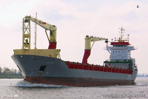
Vessel profile: Hc Eva Marie is a Multi Purpose Carrier with dimensions 18m x 146m.
This page combines live AIS, route history, probable destination signals, nearby traffic, and port activity for practical vessel monitoring.
The current position of vessel Hc Eva Marie is 2.37333 lat / -30.01833 lng. Updated: 2026-05-22 16:27:30 UTCNearest reference points:
- Open sea, approx. 402 nm off the nearest listed port
- Open sea, approx. 404 nm off the nearest listed port
- Open sea, approx. 400 nm off the nearest listed port
Details:
Live Vessel Hc Eva Marie Analytics (details, animations, etc.)
Recent AIS points (UTC):
2026-05-22 11:33:33 UTC · 1.27371, -30.33572 · SOG 14 kn · COG 15°2026-05-22 13:08:19 UTC · 1.63333, -30.22500 · SOG 14 kn · COG -1°
2026-05-22 14:17:47 UTC · 1.89167, -30.14833 · SOG 13 kn · COG -1°
2026-05-22 16:27:30 UTC · 2.37333, -30.01833 · SOG 13 kn · COG -1°