 vesseltracker.com
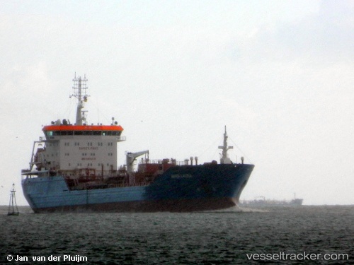
 Maria Laura
Current Status
Where is the vessel?
Maria Laura is currently in Near Waterport, based on AIS data received about 15h ago.
Latest AIS update:
Current position: 36.04788° N, 5.18547° W (Near Waterport)
Average speed (last 7 days): Loading…
Average speed (last 30 days): Loading…
Vessel profile: Maria Laura is a Chemical Oil Products Tanker with dimensions 144m x 23m.
This page combines live AIS, route history, probable destination signals, nearby traffic, and port activity for practical vessel monitoring.
The current position of vessel Maria Laura is 36.04788 lat / -5.18547 lng. Updated: 2026-05-18 05:48:46 UTCNearest reference points:
- Near Waterport
- Near La Línea de la Concepción
- Near Algeciras
Currently sailing under the flag of Italy ![]()
Maria Laura built in 2009 year
Deadweight:
17011 tDetails:
Live Vessel Maria Laura Analytics (details, animations, etc.)
Recent AIS points (UTC):
2026-05-18 01:34:38 UTC · 36.13332, -4.32028 · SOG 10.3 kn · COG 264°2026-05-18 04:10:46 UTC · 36.08485, -4.87702 · SOG 9.6 kn · COG 262°
2026-05-18 04:53:58 UTC · 36.07212, -5.01995 · SOG 9.5 kn · COG 260°
2026-05-18 05:48:46 UTC · 36.04788, -5.18547 · SOG 8.5 kn · COG 260°