 CAPE CAMDEN
Current Status
Where is the vessel?
CAPE CAMDEN is currently in Near Altenkirchen (Rügen), based on AIS data received about 14h ago.
Latest AIS update:
Current position: 54.75191° N, 13.47821° E (Near Altenkirchen (Rügen))
Average speed (last 7 days): Loading…
Average speed (last 30 days): Loading…
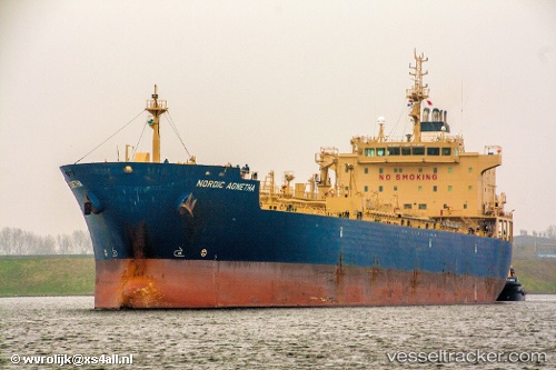
Vessel profile: CAPE CAMDEN is a Chemical/Oil Products Tanker with dimensions 184m x 27m.
This page combines live AIS, route history, probable destination signals, nearby traffic, and port activity for practical vessel monitoring.
The current position of vessel CAPE CAMDEN is 54.75191 lat / 13.47821 lng. Updated: 2026-05-18 20:22:29 UTCNearest reference points:
- Near Breege
- Near Glowe
- Near Lietzow
Currently sailing under the flag of Liberia ![]()
CAPE CAMDEN built in 2009 year
Deadweight:
37791 tDetails:
Live Vessel CAPE CAMDEN Analytics (details, animations, etc.)
Recent AIS points (UTC):
2026-05-18 16:37:31 UTC · 54.61419, 12.37836 · SOG 10.6 kn · COG 56°2026-05-18 17:33:30 UTC · 54.70724, 12.62452 · SOG 10.6 kn · COG 64°
2026-05-18 19:14:07 UTC · 54.75980, 13.11886 · SOG 11 kn · COG 91°
2026-05-18 20:22:29 UTC · 54.75191, 13.47821 · SOG 10.9 kn · COG 95°