 Parana
Current Status
Where is the vessel?
Parana is currently in 172 nm N of Primorsky Krai, based on AIS data received about 14h ago.
Latest AIS update:
Current position: 48.05520° N, 136.56800° W (172 nm N of Primorsky Krai)
Average speed (last 7 days): Loading…
Average speed (last 30 days): Loading…
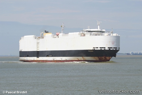
Vessel profile: Parana is a Vehicles Carrier with dimensions 183m x 32m.
This page combines live AIS, route history, probable destination signals, nearby traffic, and port activity for practical vessel monitoring.
The current position of vessel Parana is 48.0552 lat / -136.568 lng. Updated: 2026-05-19 07:43:09 UTCCurrently sailing under the flag of Germany ![]()
Parana built in 2012 year
Deadweight:
12868 tDetails:
Live Vessel Parana Analytics (details, animations, etc.)
Recent AIS points (UTC):
2026-05-19 04:42:25 UTC · 47.97540, -137.87300 · SOG 17 kn · COG 86°2026-05-19 05:30:33 UTC · 47.99560, -137.52900 · SOG 17.6 kn · COG 85°
2026-05-19 07:14:16 UTC · 48.04160, -136.77800 · SOG 17.7 kn · COG 84°
2026-05-19 07:43:09 UTC · 48.05520, -136.56800 · SOG 17.6 kn · COG 84°