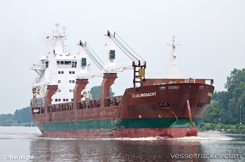
 Florijngracht
Current Status
Where is the vessel?
Florijngracht is currently in 34 nm SE of Gladesville, based on AIS data received about 15h ago.
Latest AIS update:
Current position: 34.08051° S, 152.95219° E (34 nm SE of Gladesville)
Average speed (last 7 days): Loading…
Average speed (last 30 days): Loading…
Vessel profile: Florijngracht is a General Cargo Ship with dimensions 137m x 137m.
This page combines live AIS, route history, probable destination signals, nearby traffic, and port activity for practical vessel monitoring.
The current position of vessel Florijngracht is -34.08051 lat / 152.95219 lng. Updated: 2026-05-20 04:03:39 UTCNearest reference points:
- Near Caves Beach
- 49 nm SE of Gerringong
- Near MANLY
Currently sailing under the flag of Netherlands ![]()
Florijngracht built in 2010 year
Deadweight:
12500 tDetails:
Live Vessel Florijngracht Analytics (details, animations, etc.)
Recent AIS points (UTC):
2026-05-20 01:42:35 UTC · -34.51707, 152.81920 · SOG 11.6 kn · COG 20°2026-05-20 02:34:48 UTC · -34.35531, 152.89053 · SOG 11.4 kn · COG 10°
2026-05-20 03:46:52 UTC · -34.13167, 152.93832 · SOG 11 kn · COG -1°
2026-05-20 04:03:39 UTC · -34.08051, 152.95219 · SOG 11.4 kn · COG 11°