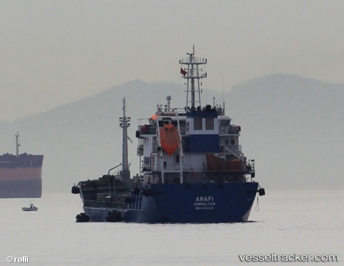
 ANAFI
ANAFI
Current Status
Where is the vessel?
ANAFI is currently in Near Waterport, based on AIS data received about 14h ago.
Latest AIS update:
Current position: 36.12768° N, 5.38049° W (Near Waterport)
Average speed (last 7 days): Loading…
Average speed (last 30 days): Loading…
Vessel profile: ANAFI is a Oil Products Tanker with dimensions 16m x 100m.
This page combines live AIS, route history, probable destination signals, nearby traffic, and port activity for practical vessel monitoring.
The current position of vessel ANAFI is 36.12768 lat / -5.38049 lng. Updated: 2026-05-18 23:07:59 UTCNearest reference points:
- Near Waterport
- Near La Línea de la Concepción
- Near Palmones
Currently sailing under the flag of Cyprus ![]()
ANAFI built in 2011 year
Deadweight:
4584 tDetails:
Live Vessel ANAFI Analytics (details, animations, etc.)
Recent AIS points (UTC):
2026-05-18 19:37:52 UTC · 36.13042, -5.38276 · SOG 0.1 kn · COG 141°2026-05-18 19:58:53 UTC · 36.12909, -5.38299 · SOG 0.2 kn · COG 86°
2026-05-18 21:25:53 UTC · 36.12803, -5.37943 · SOG 0.1 kn · COG 338°
2026-05-18 23:07:59 UTC · 36.12768, -5.38049 · SOG 0 kn · COG 4°